Q&A: Denise King on campus wayfinding project
Open gallery

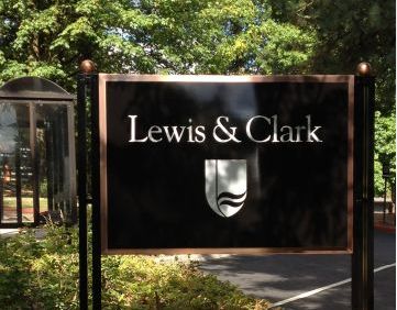
This summer, Facilities Services finished phase three of a multiphase capital project to improve campus wayfinding and signage at Lewis & Clark.
The Source caught up with Planning Specialist Denise King to learn more about the impetus for the project and the payoff for the improvements.
What was the impetus for improving wayfinding at Lewis & Clark?
Sometimes seemingly small things will trigger much larger changes, and such is the case of wayfinding on campus. I believe President Hochstettler had some initial problems finding his way around campus, and he charged Carl Vance with seeking a solution. Mr. Vance asked the assistance of a local but nationally renowned wayfinding consultant, Anderson Krygier, and then formed an L&C task force to look into the problem. The task force went through a discovery period and looked at all things associated with visitors coming to our campuses, including the following areas:
- The notion that wayfinding is more than just signage.
- The names we use for each campus.
- The ways we direct people to each campus and how we identify the perimeters of each campus.
- The way we direct visitors to specific locations on each campus.
This discovery period helped guide our next steps:
- Reinforce hierarchy with wayfinding.
- Place identifying gateways at primary entries.
- Place threshold markers at campus entries.
- Reintroduce gate numbers with updated directory information at street entries.
- Improve pedestrian and vehicle directional information.
Can you walk us through the phases of this massive project?
We realized that this was a big project and would probably not be considered for funding as it was, so we broke it into smaller, more manageable, phases.
In the first phase, we undertook a number of tasks:
- We repurposed our existing signs into campus threshold markers.
- We turned our roadway directional signs into numbered gate directional signs.
- We updated our “You Are Here” map graphics with additional visitor information and added key departments to various buildings’ identification signs.
- We launched the construction of the much-needed path along North Drive from Lower Griswold to Upper Griswold.
- We opened Huddleson Lane south of Templeton to one-way traffic with a pedestrian path to solve some of our navigation difficulties.
This phase also ushered in the orange sandwich board signs that are seen at the entrance to each gate for temporary event information.
In the second phase, we added additional building identification signs along the interior campus roadways. Initially, when these signs were installed in the late 1990s, there was a big push to be a pedestrian campus. Thus almost all of the residence hall signs were set along the pedestrian side of the buildings. The downside of this strategy was that people driving up to a building—including parents and emergency responders—could not find the building they were looking for.
For the third phase, completed this summer, we beefed up our internal vehicle and pedestrian wayfinding directories. This included more information about where to find parking, and we added four additional “You Are Here” map kiosks Additionally, for better visibility, we added orange “lollipop”-style pylons to each map kiosk.
What were the desired outcomes of the project? Are you already seeing some of the benefits of the improvements?
More people are finding their way around the campuses, and giving directions is easier. I think bringing back the gate numbers (which disappeared during the 1990s campus wayfinding update) has made the biggest impact. Unfortunately this is still a very difficult campus to navigate and without a sign on every corner, visitors often need help finding their way. Probably the best wayfinding resource we have is our staff and students looking out for visitors and offering help.
What’s on your wish list for future improvements to Lewis & Clark?
Currently I’m working on updating and standardizing our internal parking and regulatory signs, and eliminating unnecessary or repetitive signs. I’m also working with the City of Portland to revamp our ODOT directional signs to campus, and I hope to find a satisfactory location for a Lewis & Clark major gateway sign. We still need street signs at some of our internal campus intersections, and we are also looking into a Lewis & Clark wayfinding app that people could access from their smart phones. We will continue to tweak and refine the wayfinding process as we discover deficiencies and new possibilities.
Is there anything else you would like to add?
I would like to give credit to the Wayfinding Task Force and Anderson Krygier for making this a successful, fun project.
Task force members: Michael Ford, David Kelley, Denise King, Tom Krattenmaker, Tim O’Dwyer, Lisa Pogue, Carl Vance, and Clark Yeager.
Anderson Krygier team: Elizabeth Anderson, Cherry Britton, Abby-Sophia Always, and Mike Sauer.
More The Source Stories
email source@lclark.edu

